MakeLine
The MakeLine function constructs a LineString from a series of Point or LineString data.
This function isn’t compatible with all data platform connections. To check if your connection supports it, see Supported data platforms and feature compatibility.
Syntax
Function arguments:
- geo1
- Required
- A valid point or line value that can be located on the Earth’s sphere; must comply with the Geographic Coordinate System
- geo2
- Required
- A valid point or line value that can be located on the Earth’s sphere; must comply with the Geographic Coordinate System
- geo3 through geoN
- Optional
- A valid point or line value that can be located on the Earth’s sphere; must comply with the Geographic Coordinate System
Notes
-
On BigQuery, Databricks, and Snowflake connections, arguments can be either points or lines. On Starburst connections, arguments must be points.
-
When using line segments in arguments, Sigma treats the terminal points of the line as separate points, in order. For example, the following expressions are identical:
Examples
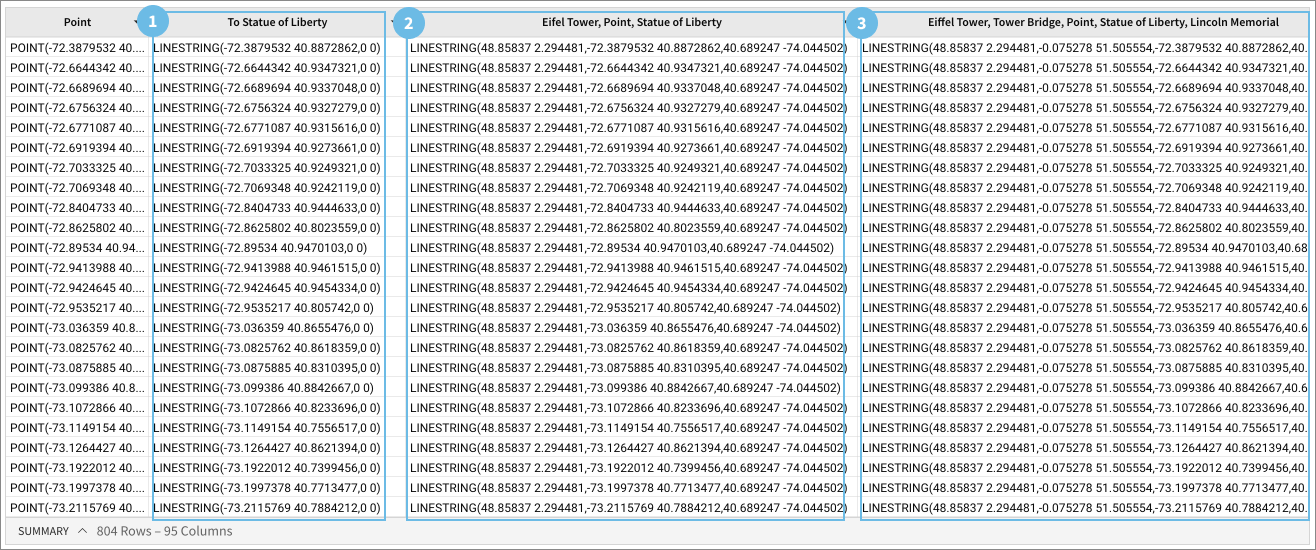
Example 1
Creates lines between the points in the Point column, and the location of the Statue of Liberty at coordinates (-74.044502, 40.689247)
Example 2
Creates lines between the location of the Eiffel Tower (2.294481, 48.85837), the Point column, and the location of the Statue of Liberty (-74.044502, 40.689247)
Example 3
Creates lines between the line between the Eiffel Tower (2.294481, 48.85837) and the Tower Bridge ( -0.075278, 51.505554), the Point column, and the line between the Empire State building (-73.985428, 40.748817) and the Lincoln Memorial (-77.050636, 38.889248).